Sunday, October 29, 2023

Flamingos At Charles Pasture, Port Aransas, Texas

We were watching the local Corpus Christi News, when the story switched to Flamingos along the Coastal Bend. Having already heard of ones being spotted on the Bolivar Pennisula we both sat up when the announcer mentioned Port Aransas! He further said that three of the birds were currently at Charles Pasture! Renita and I turned to each other and said, “We are going to Charles Pasture!”. The next morning, we got up early, loaded up the binoculars, cameras, and Renita packed a lunch. Taking the scenic route, along the coast, we drove past feeding rosette spoonbills, kingfishers perched on a wire, and lots of feeding cormorants. We ignored them all, we were birders on a flamingo mission!
Having seen flamingos in zoos, we have never seen wild ones, and they must be wild to count on our lifetime bird list. This was a once in a lifetime opportunity! The birds had been scattered north from their normal migration, from Cuba to Yucatan Pennisula, when they were caught up in Hurricane Idalia’s fierce winds. There were flung as far north as Wisconsin and all along the east coast. Luckily the traffic was light, and we were able to drive on the ferry. Crossing the Shipping Channel, we turned right at the ferry light and drove to Charles Pasture. However, there was just one car and only one birder. Walking quickly to intercept her I asked if she had seen the Flamingos. She said she had seen them the day before and that they were located at the south end of Charles Pasture. She kindly called up Google Maps on her phone, showing us where to find them. Thanking her, we drove through the Port, missed the South Charley’s Pasture sign and had to make a u turn. There was one spot left in the parking lot and in the distance, we could see a group of people at the far observation tower.
We donned our cameras and binoculars and hiked the well-made trail. At places the boardwalk was raised above the tidal waters, and it was a about one mile hike before we climbed the tower stairs. Reaching the top of the shaking tower, other birder’s pointed their location out to Renita who then helped me to spot the distant bright pink birds, (I had been looking further out. As we watched white egrets and rosette spoonbills landed in the same bay and it made a good comparison of the difference between the two pink birds.
It was a family group of two adults and one juvenile, who was a lighter pink. The birds were about three hundred yards away. Not a good distance but we could make out their distinctive features. As we watched them were feeding, they would occasionally lift their heads. Their beaks were unmistakable and their colors so much brighter than the rosette spoonbills. After an hour of watching them, we returned to our car and decided to stop At the Leorna Turnbill Birder Center. Buts those pictures deserve their own blog entry. A strong cold front is approaching, and we do not know if the flamingos will escape southward. It had been a great day with a new bird for our life list! Clear skies

Tuesday, October 24, 2023

Yankton, South Dakota

We arrived at our Nancy and Bob's new home in Yankton, South Dakota. They have a beautiful and large apartment in a fifty-five plus complex. After the welcome hugs they showed us where to park in the underground garage and they helped us with our bags. Their apartment has an elevator, which is just what we needed. The evening was spent in reminiscing about old times, and it was an early night as we were tired from the two days of driving. The next morning, we rested a bit before going on a walk in the park along the Missouri River. We also crossed an old railroad bridge that had an elevated/suspension roadway that had been turned into a pedestrian and bike path. It felt good to be able to walk again and to stretch out our legs after the prolonged trip. That night Nancy and Bob taught us how to play dominoes, a simple game called chicken foot. The game took quite a while and Nancy could do no wrong. She won five different hands and she easily beat all of us!
The next day they drove us to the Gavin Point Dam. The dam headquarters had exhibits about Lewis and Clark and from the overlook we could see boats lined up, fishing for paddlefish. The paddlefish do not bite and so the people were tossing rigs with treble hooks and sinkers. As soon as the rig hit the water each person would rip their rod upward hoping to snag one of the giant fish, (we never saw anyone hook up with one of the monsters).
The exhibits had a mounted golded eagle, an American indian pipe with pipestone from Minnesota, and a bull boat. The bull boat was made from a buffalo hide, (we highly reccomend the new Ken Burns documentary on American Buffalo). The road crossed the dam to a nice park and campground where we walked along the shoreline enjoying the nice day. One of the boats caught a fish, it kind of loo
ked like a perch, which is great to eat! Finding a nice picnic table, we enjoyed the lunch Nancy and Bob had packed. That evening we tried another game of Chicken Foot but again Nancy won. We decided that we should rename the game and call it Nancy’s Foot. She said that she had just been lucky, but it seemed to us that we would need another rematch the next evening before we renamed the game. The next day we had planned on leaving but high winds and rain made us rethink our decision to leave and so we stayed another day and night. As we hadn’t eaten out yet, we went out to eat at one of our favorite fast food places. Culvers. The food was good, but the hot fudge sundae was great, (I have gained back some weight and so ice cream is now pretty much out of my diet).
After lunch we went to the Mead Sanitarium. The first exhibits were dedicated to the nurses who trained and worked with the patients. One exbibit contained a straitjacket, (it made me remember when one of my fellow teachers had a break down and was subdued and hauled away), and another had an exhibit of techniques for lobotomies(barbaric).
There were other exhibits including several rooms describing the Lewis and Clark Expedition. That evening, Bob grilled steaks on his new Ninja Grill! After the delicious supper out came the dominoes. Perhaps Nancy eased off, but I won and Renita came in second. Talk about kind hosts! It had been a great stop, it always is with friends. They may visit us in Rockport or even come out to Wyoming for some fly fishing and bear watching. Clear skies

Saturday, October 21, 2023

From Star Valley to Yankton South Dakota

We finished the winterization of our fifth wheel and headed south, (kind of). The plan was to cross Togwotee Pass, heading first for a short visit with our friends Nancy and Bob. However, as we neared Moran Junction Renita saw on Google Maps, that there was a traffic jam along the Pilgram Creek Road. Probably a bear jam! Changing course we drove to Pilgram Creek to see rows of cars with many photographers having tripods out all set up.
They had seen a morning grizzly and were waiting for it to make another appearance. Finding a place to park, we saw there were bear management people present and that orange cones blocked the Pilgrim Creek Road. We waited for a couple of hours but the only thing we saw were more cars. Stalling for more time we ate our lunch, but we never saw any bears> we finally gave up and so we headed for the pass. Our goal for the first day was to reach Douglas but with our delay we only made it to Casper.
The next day we planned on driving over five hundred miles to reach our friend’s new residence in Yankton, South Dakota. Following Google Maps, we crossed into Nebraska and drove parallel to the South Dakota border. The road was named the Outlaw Trail, and it was a narrow and rough old road, in need of maintenance. It was the first time we have driven through the Sand Hills of Nebraska. Below the high weathered cliffs sand dunes were everywhere. The dunes are partially covered in vegetation which has anchored them in place. A small change in climate would cause the vegetation to disappear and the dunes would move again, which would be a disaster for the ranches in the dune fields.
You could see blowouts on some of the dune faces, white areas where the vegetation was striped and the underling sand was exposed. The land seems to be hovering on the edge of a knife. With climate change will the desert soon reappear?
Crossing into South Dakota we arrived at our friend’s new home. They had sold their house in Kansas, due to the high taxes on their house and because Kansas taxes pensions and Social Security. South Dakota does not have any income tax, (like Wyoming). Being welcomed with open arms we were glad to visit their new place and to rest for a few days before we headed south to our place in Texas! Clear skies ps The sand dunes are on the flat plains below the cliffs. IT is difficult to see them as they are very gradual slopes covered with the short grass prairie. In places you can see the sand peeking through and even places where lagre spots are bare of any vegetation.

Tuesday, October 3, 2023

Hiking to Phelps Lake Fall 2023

Each year we hike to Phelps Lake. This fall we waited a bit too long and due to a bear closure, the short trail was closed and the hike turned into a longer one. It added an additional 1.2miles but it was still an easy hike with only one long hill to climb. There were warning signs posted as some of the black bears have raided people’s packs and coolers, (idiots had left them unattended, a fed bear is a dead bear as the bear that eats human food, will be captured and euthanized). We did not see any bears on the hike and yes, we always carry bear spray. The first part of the hike was through a section of grass and sagebrush.
Reaching the road, we had to stop for cars, (the Moose Wilson Road). Crossing it we reached the terminal moraine, (which forms the dam for the lake), and it wasn’t long before we reached the moraine damned lake. Taking an adjoining trail, we crossed a bridge and continued around the lake.
Fred and Becky had to leave early but we sat on the edge of the lake and enjoyed the peace and quiet. A pied billed grebe chased minnows and we did see a few rises, (next time up there I am going to take some fishing gear and we do practice catch and release). It was calm and we were able to take a picture with the mountains reflecting off the lake’s surface. Heading back down the trail we took it slow but didn’t see any wildlife. Just lots of people were heading up the trail. Some of the older people, (younger than us), asked us how far it was and turned around.
Reaching our car our luck was about to change, as we headed from the LSR Preserve to the Moose-Wilson Road. Cars were parked blocking the road, a bear jam! Now usually the bear is hidden from sight in the thick bushes, but this cinnamon black bear was balancing on top of a service berry bush as it devoured the berries. I was able to park alongside the LSR road and grabbing my camera got great shots of the bear. It ignored all the traffic and people on bicycles. We watched and took about sixty images as the bear seemed to pose offering us both profile views as well as one where it looked at us, (you can see it’s eyes).
We were even lucky enough to get pictures of it as it opened its mouth showing it’s fangs and even a bit of its tongue. The light was perfect, the sun in the right position and the pics are the best black bear pictures we have taken this year, (and we were at a safe distance).
Finally, the bear couldn’t find any more berries and climbed down the tree.
It disappeared from sight and the bear jam broke up. We never did see it again, but we were excited that we had been in the right place at just the right time, (Fred and Becky had already left).
It was great last hike and trip of the year! Clear skies,

Wednesday, September 27, 2023

Hiking the Taggart Lake Trail 2023

Each year we must hike the Tagaert Lake Trail. Its trail head is easy to find, just drive the Teton Park Road and look for the traffic jam. It’s one of the spots that’s so loved that the parking lot is full before nine am and this day was no exception. Our friends Becky and Fred got the last spot, and we ended up parking alongside the road. Grabbing our bear spray and day pack, we met them at the trail head and up the trail we went. While we hike a lot, Fred and Becky are in better shape and so we were in our usual position at the tail end. Becky patiently stopped Fred until we caught up and they only had to stop for us four or five times until we reached the top of the terminal moraine, (that’s the pile of rocks that marks the lowest elevation the glacier reached and forms the dam for the lake.
The lake was perfectly calm, and they shared the above picture of the reflection of the Tetons in the still waters, (Fred posted it on his photo sharing site and at last count he had over five thousand likes, one of his highest totals). There were quite a few other people, and we took turns taking pictures of each other. Crossing the foot bridge, we parted ways as our friends were on a time constraint, (their dog was at home alone and sometimes has an accident). We loved having our dogs but decided that we will not get another as dogs are not allowed on the trails as they attract bears. Our friends returned down the trail, and we continued up and over the high point. Renita posed at the high point for a picture.
The leaves had not turned yet and so the image was not as colorful as last year. Suddenly we heard an elk bugle, and it was close! Stopping, we scanned the forest but did not see it. Another elk bugled in answer to the first and we hoped to see them fight but we never did. The elk are in rut right now and its one of the reasons we hike the trail, so we can hear them challenging each other. We passed the spot where in the past, we had encountered a bear. The bear was so close that it almost ran over Fred and he was staking its picture! As usually happens the bear fled when he stood up, he is over six feet tall. If you encounter a bear, get big, always carry bear spray and do not run! We have only been charged once and that bear stopped before we had to use it but still….
Look for the two sets of ears As we walked along the trail section, we noticed moose tracks. Another hiker told us there was a cow and calf moose very near the trail and sure enough there was a moose jam as other hikers stopped to take their picture. They were too close to the trail for comfort, and so we continued past them before taking pictures. Both were watching us and at one point I thought the cow was going to stand up, a scary thing as moose kill/trample more people than bears. We finished the hike and Renita saw that Becky had texted us.
She wrote that a large bull moose was at our favorite pond and so we drove there to join the crowd. It was where we had seen a bear before but no bears just a bull who was pestering a cow and calf moose.
From there we drove to other bear spots, but we didn’t see any, (our friend Vicky was also looking for bears and ended up taking pictures of three black bears and one grizzly bear! Talk about a lucky day)! It was time to head home, we could now check the Taggert Lake hike off this year’s list of hikes, to do in Grand Teton National Park. Clear skies

Saturday, September 23, 2023

Hiking to the Periodic Spring. on Swift Creek Trail

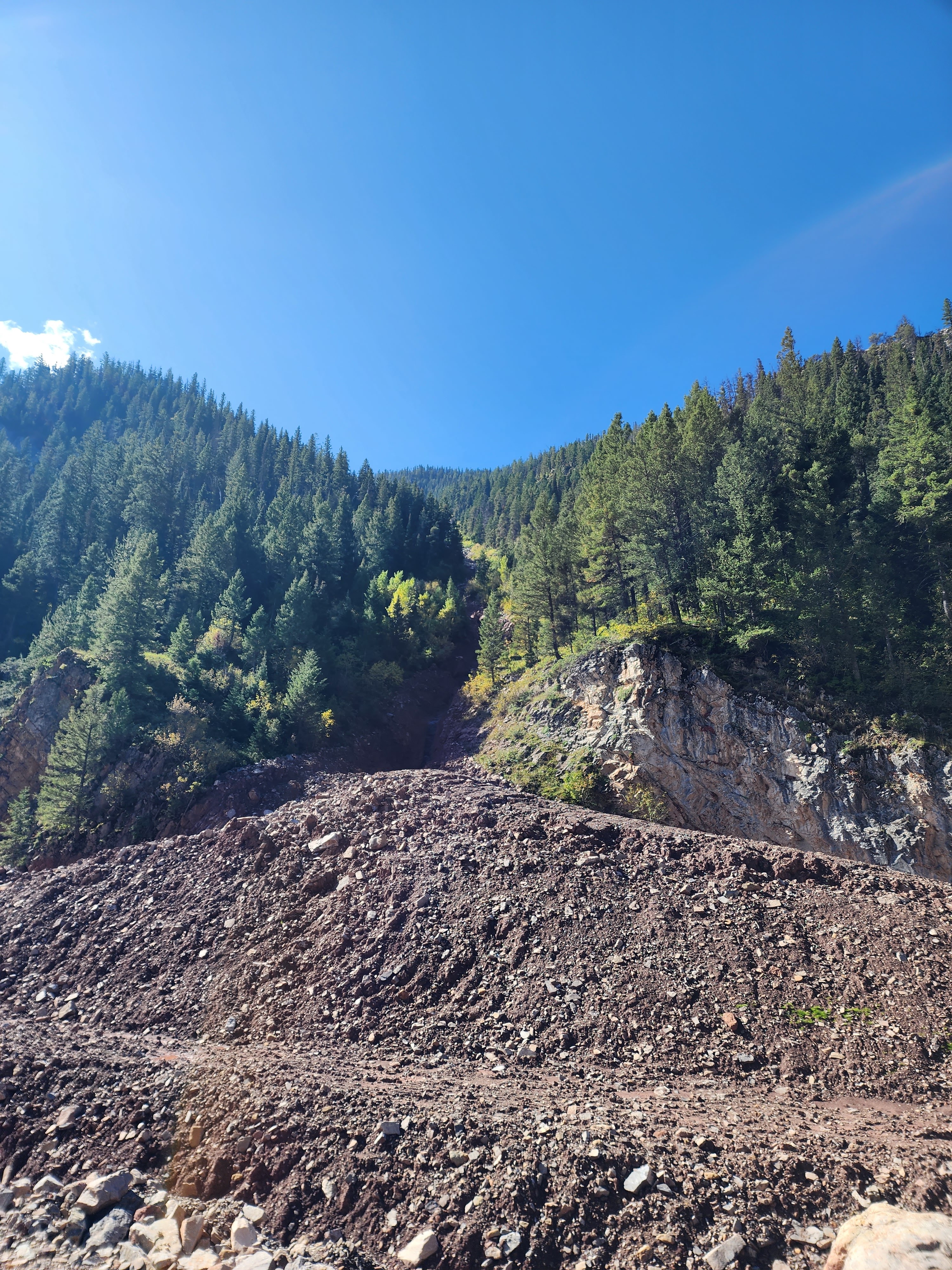
One of our favorite hikes is near Afton, Wyoming. Its name is the Periodic Springs Trail, which is along Swift Creek, (which happens to be the water supply for the town). On or about June 15th, a mud slide started slowly moving down a side canyon but then accelerated when heavy rains caused it to threaten Afton’s water supply, (source Jackson Hole News and Guide). The mudslide also endangered small two hydroelectric plants and the trail. The town of Afton provided heavy equipment and quickly repaired the damage. While an alternate trail was available, we waited until the usual route was reopened and the repairs completed.
Fred and Becky and their dog joined us for the easy hike, and in several places we could see the remnants of the mudslide. It had poured down a steep and narrow canyon and it had taken quite a bit of work to reroute the stream. The road to the trailhead is filled with large potholes but by carefully picking a line, our Subaru did not bottom out, (our friends were driving their four-wheel drive truck).
There were quite a few vehicles at the trailhead, and I armed myself with bear spray, (the chances of encountering a bear were remote but grizzly bears have been photographed in the area). There were also some unleashed large dog’s, and one of which was a pit bull. Heading up the trail, it’s only three quarters of a mile, we reached the slide and shortly the bridge which spans Swift Creek. I was the only one who wanted to climb up the trail to the springs outlet as the others had already been there and did not want to traverse the slippery rocks and sandy mud, (we are all over seventy years young).
At first the trail was easy but in places it was gradient increased and so I was forced to fourth class several spots, (fourth class means you use your hands to provide balance and security. As I neared the springs the flow in the creek dramatically lessened and so I hurried up the final bit as the flow almost completely disappeared.
I took a couple of images of the change in volume, as did Renita who was taking pics from below.
One of the changes I noted was that the board, which prevented people from entering the spring, had been replaced by brass plates, (during a normal water year the spring completely stops for about fifteen minutes, this is not a normal year).
Heading back down the trail was more challenging than the hike up and in one place my foot slipped but I had firm handholds and safely passed the troublesome stretch. The trail was also more challenging as it was wet and I don’t have the balance I used to have. I finally reached our group who were taking pictures of the temporally dry stream bed. From there we watched as a group climbed the trail. They did not seem to have any problems although at one point the mother grabbed her two-year-old toddler, (oh to be young again and ignorant of the dangers involved). In a side canyon two others were climbing the cliff face without ropes and at one point dislodged a rock, unaware of an older person sitting below. No one yelled rock as a climber would do to warn any person at the bottom, and I realized these were either not climbers or people that spent most of their time on manmade climbing walls. We decided to head back down and passed many people starting the hike. It had been a great day, but I decided I would not hike the wet and slippery trail again. That night I discovered that I had pulled a muscle and could not go down any stairs without pain. (luckily I recovered and four days later was able to hike the four mile Taggart Lake Trail in Grand Teton National Park. That’s the next Blog…… Clear skies

Saturday, September 16, 2023

Another day of sharing our love of Grand Teton National Park with Friends

It’s been ten days since I last wrote a blog entry. My excuse is that it has been a busy time with bear watching with friends, selling at a new show, and looking to purchase a park model, and hiking to the Periodic Springs. One of our dear friends Betty, who lives in Iowa, has been wintering at our rv park in Texas. There we have met her family including two of her daughters, Melanie and Alana. This spring Melanie mentioned to us that she was planning on taking a trip to Glacier and Grand Teton National Parks. Renita and I love to have visitors and told her to call us and set up a time to meet at the park headquarters in Moose Wyoming.
They told us that they had seen elk, antelope, deer, and a mountain goat but had not seen any bears or moose. The pressure was on! Renita and I talked it over and decided to take them to Sawmill Pond. The men rode in one vehicle and the women in another so Renita and I could regale them with our stories, mostly true. One of our favorite places,it was was not very far away, and as we neared the spot we saw cars, pickups, a large crowd of people and the parks wildlife management group. A bear jam in progress! Finding a place to park we joined the throng and had several people point out the black bear. It was under a tree, behind bushes, and difficult to see.
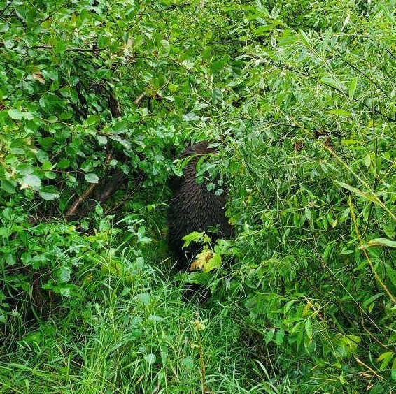
As usual I had the camera on autofocus. The bear was basically a black smudge in the dense brush. IT started to move, and I got one shot as it walked across an opening. Of course, the autofocus took a great picture of a branch and a blurry picture of the bear. Before I could change to manual focus the bear was gone from sight. Our favorite trail was still closed and so we continued along the road looking for more bears. While we didn’t see any bears, we did spot a cow moose feeding in a small pond.
In the first picture taken with a 75-600 mm lens you can see the bugs, (little specks), that are bothering her.
The second picture was taken by Melanie with her cell phone and the third by Renita with her 75-300 mm lens.
From there we drove the Teton Park Road without any success. Still we pointed out the places we had seen grizzly and black bears, and the rockslide on the mountain. Other points of interest were the Potholes where ice was buried during the last glaciation. It had melted during the last five hundred years, and settled forming depressions, which filled with trees, (not the same as sinkholes which form above cave systems) These depressions are places where the elk calve and are frequented by grizzly bears in search of an easy meal. From there we headed to Coulter Bay for lunch before driving past the dump road, Pilgrim Creek and one of our favorite trailheads, No bears, moose. elk were posing for pictures and so we next stopped at the location of Cattlemen’s Bridge, (long since gone).
Looking down the Snake River we could see American white pelicans, double crested cormorants, and common mergansers. All the birds were resting after feasting on fish. They must have a fishy breath as they tend to hang together!
A mature bald eagle perched on a tree but did not provide us with a clear shot! From there we drove to the Oxbow and then returned to where we had started. No bears were visible, and we took a last ride down the narrow road. The men’s car took the lead and soon after we had passed a spot the women had to stop to let a bear cross the road.
It ignored them and started to feed on the berry laden bushes. It was so close they had to keep their windows up! The bear was so close that the best picture was taken by Melanie with her cell phone. Driving further they spotted a moose, and a bull elk. We never got a good pic of the elk and when we turned around to see the bear, we only saw moving bushes. A Bear management person told me to roll up my window. The bear must have been in the ditch but none of us could see it. Our last meeting was at the Sawmill Pond, where a moose had appeared for more pictures. Our last wildlife enbcounter was of a herd of cow elk on the ridgeline and ended our great day in the park!
Everyone had seen black bears, and moose so now our friends had checked most of their animal boxes. They had not seen any grizzly bears, but we later learned there were two feeding alongside the Towgotee Pass Highway. Perhaps next time! Thanks for the visit, we love sharing our knowledge of Grand Teton National Park! Clear skies