Showing posts with label Tennessee. Show all posts

Wednesday, November 16, 2022

A Red Shouldered Hawk and the Houston Gem and Mineral Show

Yesterday, our friend Jane knocked on our door. She told us there was a large hawk perched on a post next door. Assembling our camera, with the Sigma 150-600 mm lens, I followed her out and after help I finally spotted the beautiful bird.
We were sure it was a red shouldered hawk, and while we have taken pictures of one before, we have never had one pose so close for so long. It repeatedly turned it’s head giving us profile after profile and looked at us face on. Moving to another spot, we used their truck to hold the camera steady and continued to take more images. Dave asked me if I had taken enough and laughed when I said I had only snapped a little over one hundred pictures< In one photo I caught the hawk blinking.
Instead of an upper and lower eyelid they have a third eyelid called a nictating membrane. It keeps their eye moist and clean, like we do. In some birds it also protects the eye and allows them to see when they are underwater, (like a kingfisher).
The wind was blowing strong and at one point almost blew the bird off its perch. It’s feathers had been puffed up, it’s a cold forty five here, and so it decided to take off for a better spot.
I forgot to zoom out as it got antsy and so my flight pictures were not the best but still the detail was great! We also traveled to Houston to see our cousin Angie and her husband Pete. We stayed with them and attended to the Houston Gem and Mineral Show. Pete is a retired geologist and also collects specimens so we all enjoyed the show and made purchases.
Checking out all the booths/tables, we found several rocks we did not yet have. One type of Jasper is called a Dalmatian jasper, another a fossiliferous crinoid marble,
and a third was a black nephrite jade from Australia, (the Australian Jade was given to us by Angie who had found it while cleaning out her Dad’s house).
We also looked for a pectolite called larimar, which is only found in the Dominican Republic.
Its an expensive rock and has multiple hardness areas making it difficult to cut. Not finding any rough we broke down and bought five, very expensive cabochons, (they will probably end up as Christmas presents and will not be sold). Besides rocks we went out to eat including at a place that advertised the World’s best chicken fried steak, (I still think the one I ate in Hondo, Texas is the best)! As always we had a wonderful time with Angie and Pete, thanks for the invite! Clear skies

Sunday, May 17, 2020

Homeward Bound


It was finally time to head north. We had stayed for a full month longer than we usually do because our place in Wyoming was not yet open. The temps in south Texas heated up and the humidity made it more than we could stand so we spent most of the day indoors. The plan was to drive the seventeen hundred miles in four days, which is a huge mount of driving without breaks.
The first day on the road was a drive of four hundred plus miles to Sweet Water Texas. Once we got on the way, (we had a lot of prepare the fifth wheel for storage), it was ten thirty which meant that we would get to Sweet Water about six in the afternoon.
If you have never been to south Texas, the area we crossed was really flat. At least there were lots of scrub brush to break up the monotony and crossing several rivers. All of the rivers we crossed were low due to the drought that eastern and central Texas is currently undergoing. Gas was cheap and when we reached Sweet Water, we found a nice place to stay along with fast food restaurants nearby.
The second day was another drive of about the same length but this day we drove through some areas with buttes, and the area near the Canadian River was really quite pretty. It reminded us of some areas in southwest Wyoming.
This day we as we neared Oklahoma a warning light came on. We had never seen a warming light on this car and this one said that a tire was underinflated and needed to be checked. Renita even got a text message from Subaru!
We had just left Perryton, Texas and turning around we went to Perryton Tires, There the staff welcomed us and got our car in and after removing the tire and looking for a leak, put the tire on and sent us on our way free of charge. We offered to pay but the tire man thanked us and said no payment was necessary! If anyone ever sees them self in need of tires or service Perryton Tires is the place to go!
After spending the night in Garden City, Kansas we left on day three for another leg to Sidney, Nebraska. There were lots of detours and we got off route so bad that our gps stopped receiving data. We found a map of Kansas, in a small convenience store in Atwood, Kansas. We decided to take a longer route to get back on track as the road we had been on was narrow. It had rained most of the day and we dreaded going on such a road with no shoulders.
The highlight of the day was when we stopped at a small picnic area. There two American goldfinches flew nearby and landed in a small bush next to the car. They were brilliantly colored in their breeding plumage, (and puffed up from the cold temperatures as it was forty-five degrees Fahrenheit), but they flew away before we could get any pictures.
We reached Sidney, Nebraska and were shocked to see the gas price was fifty cents higher per gallon than the town that we had passed through forty miles earlier. It seemed like price gouging to the extreme which is pretty typical when you are in a town next to the interstate.
We left Sidney and drove across Wyoming, stopping for the night at the Little America on Interstate eighty. It was an easy drive, a little less than four hundred miles.  The mountains were covered with snow and it was so nice to see mountains!
Our rv park did not open till the next day and so we were only one hundred and fifty miles away. It was the first time we have stayed at Little America and the room was nice but dated. They do have two grills there and so we had our usual chicken and cheeseburgers. The highlight of our stay there were the two red breasted nuthatches that stopped to look at us before continuing their hunt for bugs.
The final day started with a short drive and we arrived at eleven am. The rest of the day was spent checking for damage, (no damage to our fifth wheel), and unpacking. It is amazing how much stuff we brought in our Subaru.
Clear skies


Monday, October 24, 2016

From Branson to Tallahassee, Miles and Miles

We left Branson, Mo and drove some of the hardest miles. Taking US Highway 65 south, the road turned bad, in Arkansas, from four lanes to two. Further it narrowed and old style high curbs threatened our new tires.
Pushing on into Little Rock the road seemed to be an endless series of peaks and valleys and on one I misjudged the gradient and the truck heated up. Stopping near the top of the hill I admired the view but decided I would cross Arkansas off in my new road atlas.
Arriving at Little Rock Renita found a beautiful place to camp, at Maremelle Park. It was on the Arkansas River, and being a Corp of Engineers, (COE) campground it only cost us twelve dollars a night. Sitting for two nights we rethought our route and took Interstate 40, crossing the Mississippi River and driving to Tupelo, Mississippi.

At Tupelo, I noticed that the truck was making a noise and that the alternator seemed to be struggling to keep the batteries charged. Making an unscheduled appointment at the Chevy garage we found out that the noise was in our transmission, at low gear, and that the batteries needed replacing.
After this we had them check everything else, and getting the all clear we drove to Montgomery, Alabama. There we got lucky, it being a weekend, and got the last spot at Gunter Hill COE. It’s one of the best campgrounds we have stayed in and rested for three days before continuing our cross county oddessy.
From Montgomery, we drove south and east and finally reached Tallahassee, Florida. Here we have stopped to visit some friends Bob and Sue. We had met them eight years ago, when we started our full time rving adventures. When we met them they were also full timer rvers, but have since settled back into a house, along with their four dogs.
It’s one of the best things about being a full time rver, meeting new friends from all over the USA.  The plan from here is to rest and then stopping at Crystal River and then St Petersburg. There we will spend two months before heading back west. Clear skies.


Thursday, October 22, 2015

Chickamauga and Lookout Mountain, Part 2

It was about a seven mile drive from Lookout Mountain to the Chickamauga Battlefield. We had stopped at the Visitor Center the day before so we drove to stop number one, dialed the phone number and listened to the recorded message.
It was basically the story of the first days fight where the Confederates had been delayed by the lighten brigade allowing the Union to establish a defensive line. Stop two told of the next day’s attacks, all repulsed. The lines here were well marked with monuments to the opposing forces, including the largest monument named the Georgia Memorial.
Stop four was where disaster overtook the Union forces, when the Union General, safely far back from the fighting pulled troops from the center. He had made the mistake thinking a gap existed on the left where none existed and crated a huge gap in the center. The Confederates attacked, found the gap and split the Union Army/
When the Confederates came out of the woods by the Union Generals headquarters he mounted his horse and rode off with other generals telling his staff it was every man for himself, (he rode off to Chattanooga and made no attempt to rally his forces.
The right side of the line was held by the Lightening Brigade, a Union Mounted Infantry Brigade armed with Spenser Repeating rifles. They held off numerous attacks before being forced to withdraw and their position is dominated by their Memorial to Wilders Brigade. It’s a high tower and you can climb the stairs to the top.
As the Union forces were being routed, the only remaining Union Major General, George Thomas, pulled troops together and formed a line along the Snodgrass form.
He set up his headquarters about one hundred and fifty yards behind the lines which he established along a horse shoe shaped ridge.
There he rallied forces who then held off attack after attack allowing the retreat of the main Union forces to Chattanooga, (and he was given the name the Rock of Chickamauga).
Later he and his troops would distinguish themselves when they took the right flank of Seminary Ridge. In that Battle Sherman’s Corp had been stopped in their attack up the left flank. Thomas’s force was order to simply take the rifle pits at the bottom of the ridge but instead fought their way to the top, taking the cannons and routing Braggs Confederate Forces, (Braxton had made a mistake and put his defense on the actual crest of the ridge instead of on the military crest and so his forces couldn’t fire down on the attackers.
We have been to many of the Civil Wars major battlefields including Shiloh, Gettysburg, and Antietam. All are sites were men fought with honor and courage and all are hallowed ground. All are places people today should visit.
Perhaps then the idiots here who call for succession and the idiots in Congress would spend their time trying to heal and fix what is wrong with this country instead of simply fighting against anyone who suggests hope. These are the people who Roosevelt talked against when he said,”the only thing we have to fear is fear itself”.

Clear skies 

Tuesday, October 20, 2015

Lookout Mountain

I was lucky enough growing up to have lived close, six blocks, to a Carnegie library. As a small child, I remember the day when I was old enough to check out books at the adult library. Flying up the stairs I got my adult library card and decided that I would read every book on the shelves.
Of course I never had a chance but I did read every science fiction and history book I could and if I hadn’t become a science teacher my next choice would have been history.
So since we have been traveling, we have now been on the road starting our ninth year, I have tried to visit places I have taught or read about. You can probably guess why we were in Chattanooga, I wanted to visit the Chickamauga Battlefield and Lookout Mountain.
Stopping at The Chickamauga Visitor Center we were given a map, detailed directions, and told of the new phone guided tour number. It would allow us to dial a prerecorded number, enter the site number, and get a description of what we were looking for at that stop. Wow did it work great!
So the next morning we got up and hurried off to Lookout Mountain. Now the battle for Lookout Mountain took place after the Battle of Chickamauga but there was a reason for the order. From the Lookout Mountain’s Point Park one can see Moccasin Bend, Chattanooga, Seminary Ridge, and Browns Ferry.
Lookout Mountain actually fell before the final battle when the Confederates withdrew their troops and cannons, trying to shore up their defenses on Seminary Ridge. The drive up to Point Park was over narrow and winding roads that were not easily navigated by out truck, (we got there early and were able to get a parking spot behind the visitor center, and we would not have fit in a street parking spot).
Looking down we could see Browns Ferry, which Grant’s troops secured, relieving the Federals troops besieged by Braxton Bragg, (the Confederate General). Inside the visitors center is an amazingly detailed and huge painting of the Battle of Lookout Mountain.


It is so detailed that you can actually see the rings of smoke from the cannon fire and see how the up slope wind carried the smoke rings up the mountain. After studying the painting we next walked to the Peace Monument and then to each Confederate Battery.
At one of the viewpoints there were displays of signal flags and hardtack, a whole case! Time however was not on our side and so we returned to the truck and headed down the mountain to the Chickamauga Battlefield. End of part One. Clear skies

Wednesday, October 23, 2013

Shiloh

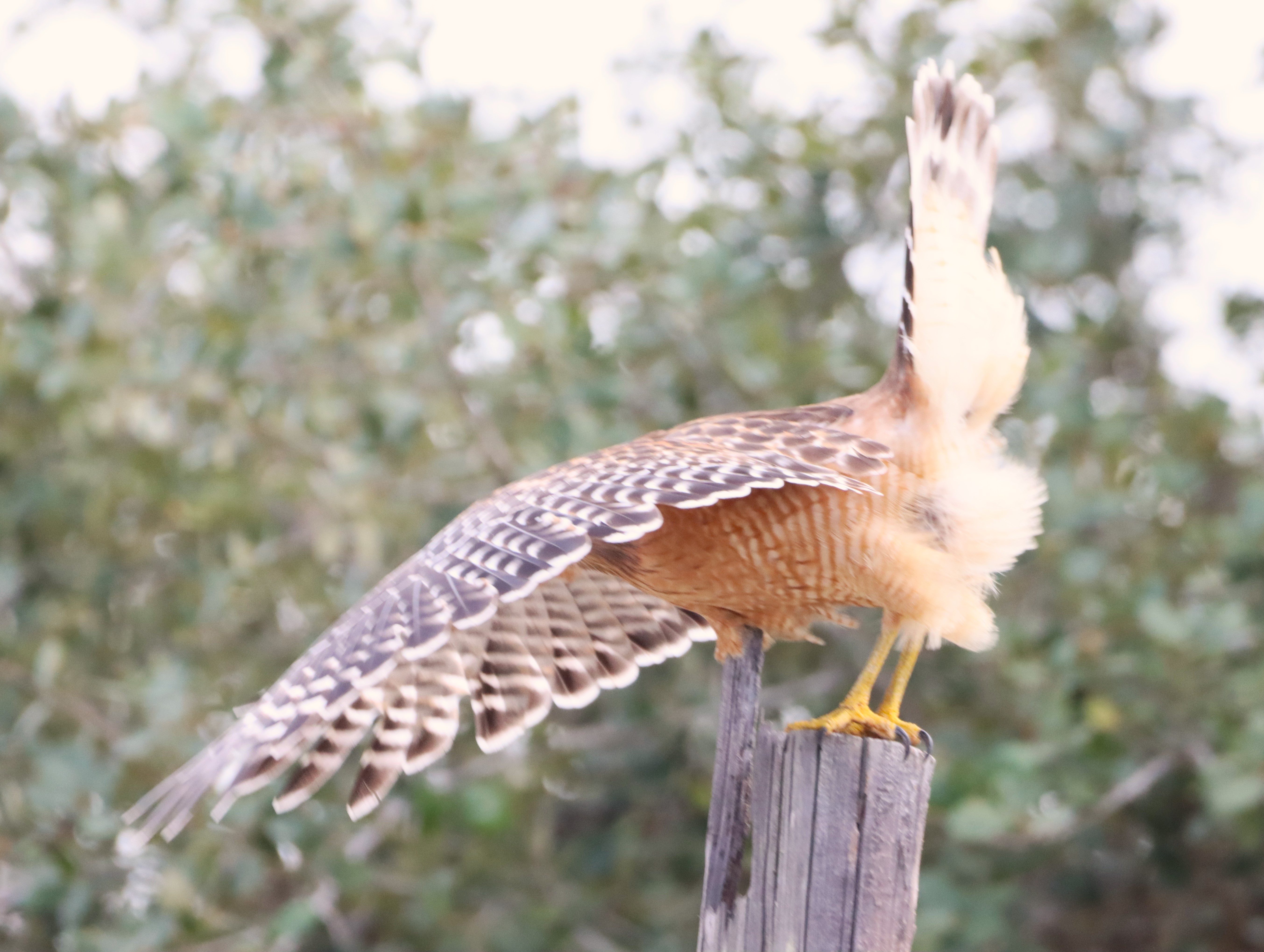
We walked along the Sunken road, its not really sunken, and stopped at each monument. Here were stones placed to commemorate each of the Iowa regiments that held at a place called the Hornets Nest against attack after attack. One of them,  the 12th Iowa, had even had to about face and repel an attack from the rear. They eventually were surrounded and had to surrender, but the dying hadn't stopped. Seventy one of the men died in a Confederate prison.
It wasn't just Iowa regiments that held here, Missouri, Michigan, Indiana, Wisconsin, Kentucky, and Ohio markers were all represented. The survivors, (over two thousand were surrounded and captured), finally retreated to Grants final line but they had held long enough. Johnston's final attack failed and Grant attacked and won the battle the next day.
Shiloh was the last on my list of Civil War Battlefields and in preparation I had bought the battlefield guide, Shiloh. Its over one hundred and seventy pages long and so I read it in advance and thought I was ready to guide us in our drive from stop to stop.
However it wasn't like Gettysburg or Antietam and we quickly became confused due to the thick forest. It made us understand the confusion that the undergrowth and rugged terrain had caused in the rebel lines. Finally figuring it out, we found where the battle had started and were able to trace the sequence of events.
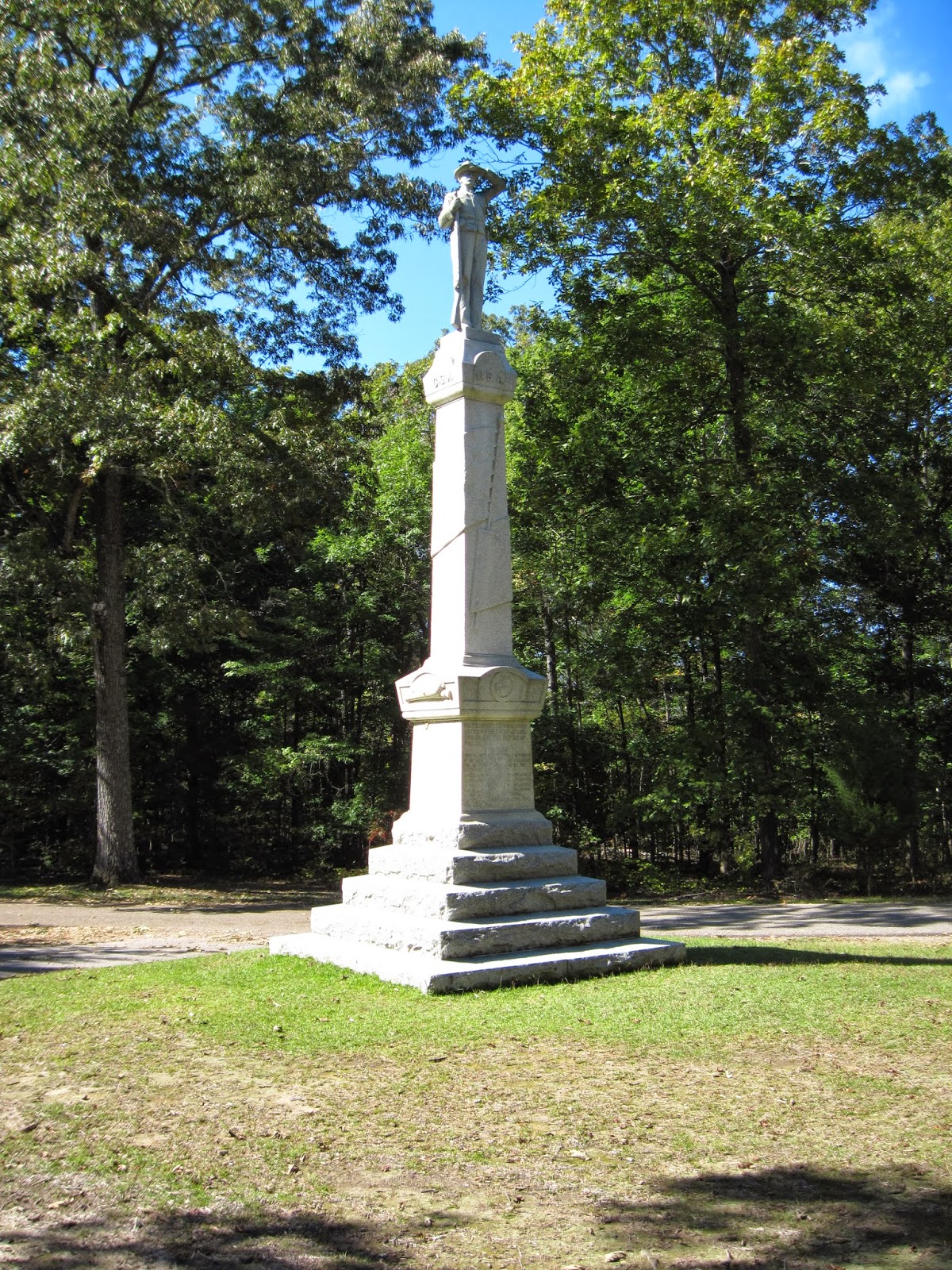
Pausing at the Confederate monument I simply could not comprehend the bravery showed by the soldiers on each side.
Bloody pond was next to the sunken road, and we watched fish swim lazily in the shallow sunlit water. The myth said the pond was named for all the blood from the wounded and dead that stained its color but its another of those myths that surround this place.
A cannon stood where each general was killed, and it wasn't really surprising how close Lew
Wallace's and Sidney Johnston's monuments were to one another. Each step we took was on sacred ground and we both were silent in our thoughts. I had no relatives that had fought here, mine had passed at the siege of Vicksburg, and not from battle wounds but from mosquito borne sickness, (their Iowa regiment of sharpshooters had been place in a swamp).
Our last stop was where the final Confederate attack failed as the men had to cross  a creek and climb a steep hill. During all that time they were bombarded by Union gunboats, shot at from the final line and further bombarded by Union batteries.
The park headquarters here has a hour long movie that we both highly recommend should you ever visit here. The battle field guide we used was simply too much to properly use in the time we had, (the book says six hours is required to visit the sites but we used most of a day for the first day of the battle). I wish everyone could walk this and other such places to realize how special our country is and the heavy price paid. Perhaps then they wouldn't sign fools petitions demanding succession.
Clear skies.

Tuesday, October 22, 2013

The Rig is Fixed, Heading South


We took our rig in on Monday and it was fixed, as promised by Friday. The Heartland Customer service people explained all they had done to make the necessary welds and basically said they had rebuilt the front end to 2013 standards!

They had also fixed numerous other problems and it still seems like we keep finding things they fixed! So our hats are off to the outstanding job done by the Heartland Customer Service Center. Thanks to John H, Eric and the others techs responsible for the job well done, (oh and lest I forget thanks to David H for setting it all up)! Heartland treated us as a company should and stood behind their product, even though our warranty had expired.

So we reloaded the rig, resupplied the larder and refrigerator, and hooked up for a Sunday drive. The plan was to push it for three hundred and fifty miles, clear south to Cave City, Kentucky. Now we had already visited Mammoth Cave so other then enjoying the sights of beautiful state of Kentucky, we continued south to Tennessee. Crossing the state line we entered Louisville, where our gps took us on a strange loop of about five extra miles. It even took us back to the original starting exit/entrance.

Nashville, greeted us with heavy fog warnings, but we were able to drive through them and could actually see a little bit of the city. Turning west on Interstate Forty, a Natchez Trace Parkway sign quickly caused us to change our route as we decided to drive down the parkway.

Renita got behind the wheel and drove along the trace. The speed limit on it is fifty miles per hour, but with no trucks and little traffic she drove slower so I could enjoy the view. Notice I said I could enjoy the view as she had to really concentrate to keep the wheels on the narrow road, (It reminded us a lot of some of the interior Alaskan roads and Cassier Highway, both narrow roads with no shoulders).

The falls colors were not yet in their peak, but it really didn’t matter as it was a pleasant day driving the Natchez Trace, (If you ever get a chance follow the spring flowers north along the Trace). Turning off the parkway I took the wheel and drove the rest of the way to the Pickwick Dam Campground. There we found a beautiful, large campground, with long and level sites, spaced among towering Southern Pines.

To top it all off, it’s a Tennessee Valley Authority campground and it only costs eleven dollars a night with my senior pass, (first time I have been able to use it for camping). The campground is located on the Tennessee River and is just below the Shiloh National Park, which we plan on visiting tomorrow. Clear skies.